|
|
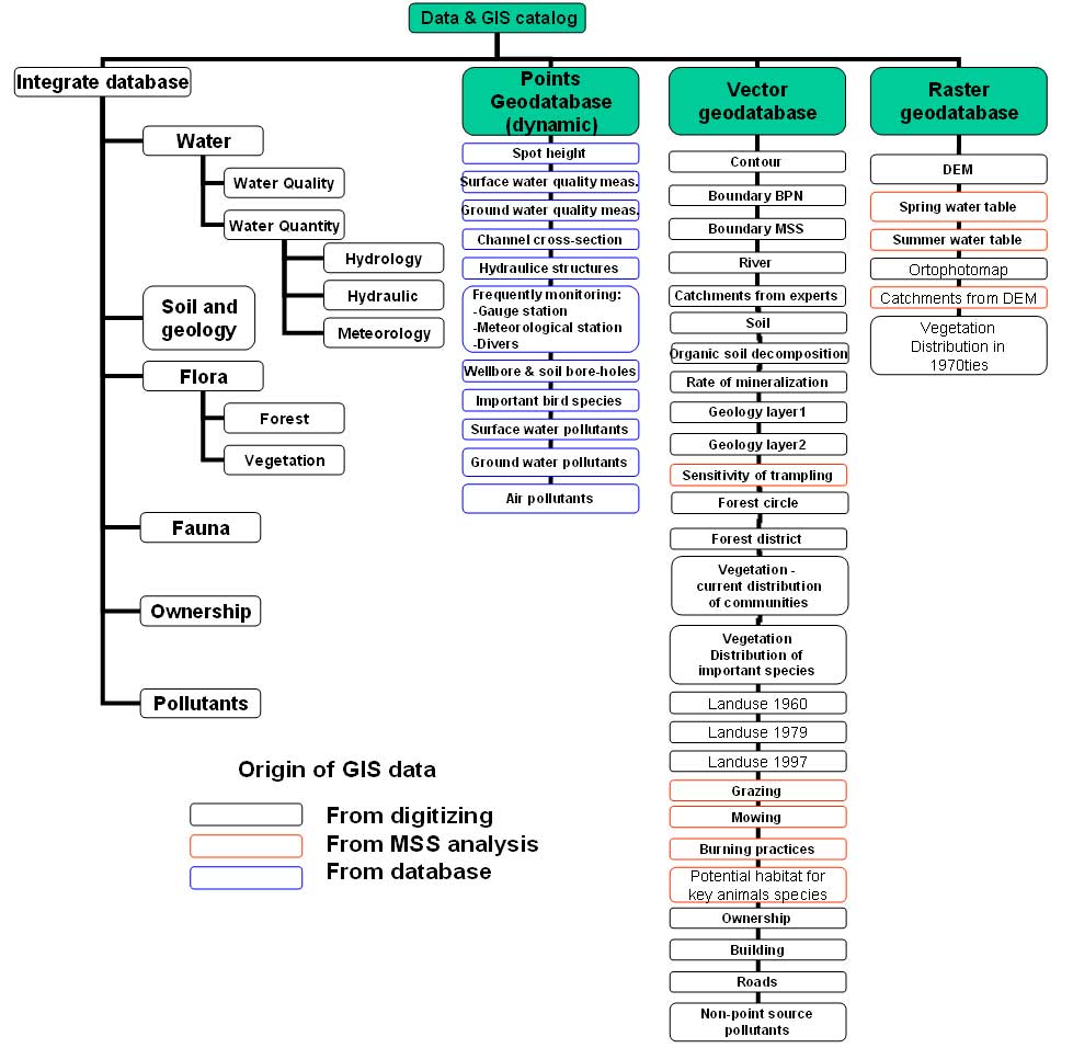
General aim of MSS
- Collect and ordered data through unification their forms
- Improvement access to data through location their in
database
- Enable efficient and complex data collection from the
monitoring networks
- Improve and fasten the process of data exchange between
partner institutions
- Enable preparing periodic/end of year administrative reports
- Enable complex analyses and assessment of the spatial
issues; in particular:
- changes in land use and water management and their
influence on ecosystems’ functioning/growth/development and diversity,
- spatial effects of the environment protection;
- Provide clear and precise presentation of existing/expected
problems and constraints, which improves cooperation with land/water
users, local, regional authorities; and enables/facilitates applying
for different types of financial support
|
|