|
Management Support System for Biebrza National Park :: Hydrological module :: |
||||||
| ..::: Home :: Contact :: Wersja polska :::.. | ||||||
|
|
Draft for structure and operationThe hydrological module predicts the changes in water conditions as a function of changes in climate and nature management regime. The hydrological module consists of mathematical and statistical models of water quantity and quality (models of surface water and groundwater sub-systems as well as nutrient load model). The models are integrated on output level, what means that the output from the one model is an input to another mode. An operating scale could be spatially different for different models. Hydrological module scheme: 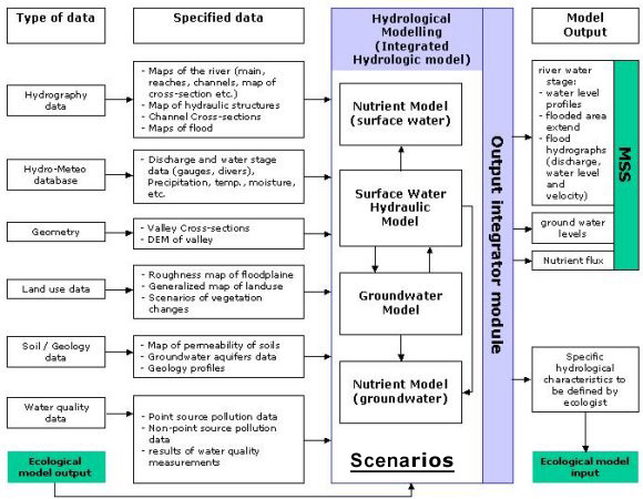 |
|||||
|
|
||||||
|
||||||