WETFLOD
Integrated wetland flow model: tool for management adaptation in protected wetlands
2013-2015
Project Abstract
The main objective of the WETFLOD project is to develop an integrated hydrological modelling tool capable to simulate accurately the dominant hydrological processes of the floodplain wetlands under the conditions of flood. The elaborated tool will integrate 1-D hydrodynamic model of the channel flow (river Biebrza), 2-D hydrodynamic model of the sheet flow on floodplain (within the flooded and vegetated valley) and a 3-D groundwater flow model simulating the interrelation of aquifers of peat and underlying sand. Model integration will allow the assessment of continuous feedback of surface water and groundwater. Detailed field and analytical research will be undertaken in order to collect a high quality hydrological and remote sensing data and apply them in the calibration and validation of the integrated model of floodplain wetlands in the Lower Biebrza Basin. The project includes a high resolution research on wetland topography and vegetation structure (LiDAR technology), vegetation mapping (including LAI field measurements), groundwater and surface water levels measurements in 30 measurement points and accurate measurements of floodplain surface flow velocity along with the flow directions assessment. Results of the scientific research as well as the developed integrated wetland flow modelling tool WETFLOD will be applied in testing of various management measures (shrub removal, meadow mowing, wetland drainage) influence to hydrology of the Lower Biebrza Basin as well as in the analysis of wetland ecosystems responses in order to provide science based guidelines for adaptive environmental management in the Biebrza National Park.
The project is divided into 2 groups of tasks: (I) hydrological modelling (task 1-5), where necessary data and models are developed and (II) management adaptation (task 6), where results from tasks 1-5 are implemented, being the practice-oriented approach supporting the environmental management in the Biebrza Valley. The common relation between the project tasks is presented in Figure 1.
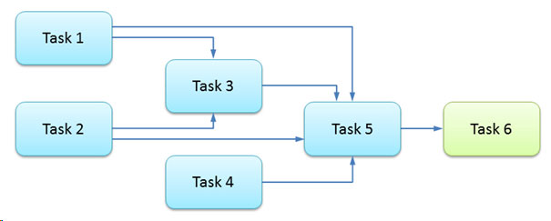
Fig. 1. Generalized flowchart of the project realization
Task 1
Setup of the monitoring network and monitoring activities.
This task is to undertake indispensable, seasonal and permanent monitoring activities in order to collect field data to be applied in conceptual and numerical models. The task is subdivided into three major groups: vegetation monitoring, hydrometric monitoring and groundwater and surface water monitoring.
Task 2
Development of land surface elevation model, vegetation, vegetation structure and vegetation height maps.
In this task the vegetation structure and land surface elevation model will be elaborated.
Task 3
Conceptual and numerical model of groundwater circulation in the research area.
Task 4
Integrated Wetland Flow Model – numericalcode elaboration and testing.
The main goal of this task is to perform and execute numerical algorithms for the integrated model (MODWETFLOW) simulating surface and groundwater flow on wetlands.
Task 5
Integrated Wetland Flow Model – application and scenarios.
In this task the developed and tested MODWETFLOW will be implemented for the research area located in the Lower Biebrza Basin.
Task 6
Model-supported enhancement of adaptive wetland management in the Lower Biebrza Basin in reference to analyzed hydrological pressures
This task will incorporate results from all the previous tasks, being the practice-oriented approach supporting the environmental management in the Biebrza Valley. The developed MODWETFLOW model with the set of included components (vegetation, hydrology, flood dynamics) will be applied to verify the influence of various management scenarios for contiguity of protected habitats and species.